العودة للرئيسية

أقمار صناعية

أقمار ناسا تتابع تطور ظاهرة النينيو في المحيط الهادئ

تاريخ المصدر:

المصدر الأصلي: ناسا — NASA

المسؤولية التحريرية: إدارة تحرير الفضاء اليوم
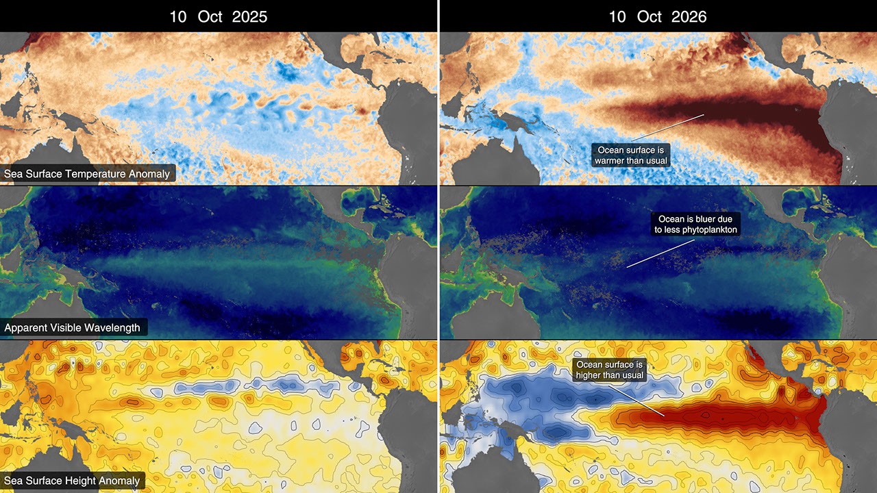
A 2x3 grid of six frames all showing data overlaying the Pacific Ocean. The left column shows the data from 2025 while the right column shows data from 2026. The top left frame shows shades of brown and blue in the ocean, where the blue color is primarily centralized. The top right frame shows a large swath of red, primarily over the equatorial Pacific. The middle left frame shows deep blue in the water with a swath of green along the equatorial Pacific. The middle right frame shows primarily bl
الصورة من المصدر الأصلي

تستخدم ناسا قياسات الأقمار الصناعية لمتابعة تغيرات حرارة سطح البحر وارتفاعه أثناء تطور ظاهرة النينيو في عام 2026.

تساعد بيانات الاستشعار عن بُعد في رصد انتقال الحرارة وتغير أنماط المحيط. يعرض المصدر خرائط مقارنة بين عامي 2025 و2026، بينها قياسات ارتفاع سطح البحر من أقمار سنتينل 6.

ملخص عربي أُعدّ بالذكاء الاصطناعي استنادًا إلى المصدر الرسمي. يُرجى الرجوع إلى المصدر للتفاصيل والتحديثات.

Original English headline and source excerpt

NASA Satellites Observe Historic 2026 El Niño

Read the original source

الإبلاغ عن خطأ في هذه المادة